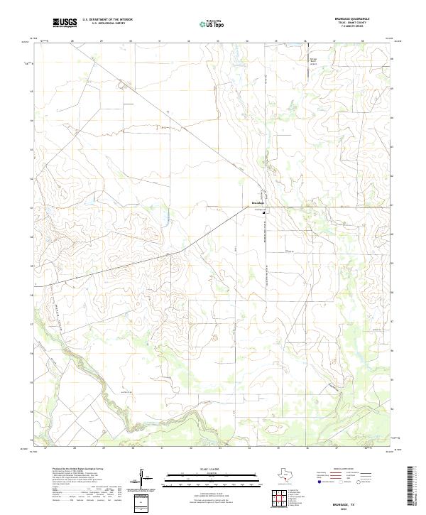
2022 Map of Brundage
USGS Topo · Published 2022About this map
Brundage stands at the intersection of FM 65 and FM 190 in this part of South Texas, characterized by the winding path of the Nueces River along the southern border. The landscape is defined by its drainage patterns, including the prominent Tortuga Cr flowing from the north and the low-lying Soldier Slough near the riverbanks. Local infrastructure supports both agriculture and ranching, evidenced by the presence of the Tortuga Ranch Airport and a network of rural routes such as Hasten Co Rd and Bermuda Co Rd. Genealogy researchers will find the Brundage Cem just east of the main settlement, while the name Brundage Steak House Rd suggests the site of local commerce. The terrain transitions into notable depressions like Stag Hollow, reflecting the arid geography of Dimmit County.
Find a feature on this map
18 named features on this map. Tap any name to fly to it.
Don’t see what you’re looking for? This feature index may not catch every label — zoom into the map to look around manually.
Map Details
Editions of this 2022 Brundage Map
This is the sole edition of this map. No revisions or reprints were ever made.
Other maps of this area

1925 · San Roque Lake 1-a
USGS Topo · 1:48,000

1929 · Cotulla
USGS Topo · 1:125,000

1932 · Valley Wells
USGS Topo · 1:62,500

1939 · Carrizo Springs
USGS Topo · 1:62,500

1939 · Big Wells
USGS Topo · 1:62,500

1940 · Asherton
USGS Topo · 1:62,500

1940 · Catarina
USGS Topo · 1:62,500

1953 · Crystal City
USGS Topo · 1:250,000

1955 · Crystal City
USGS Topo · 1:250,000

1961 · Crystal City
USGS Topo · 1:250,000