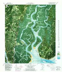
1979 Map of Brunswick East
USGS Topo · Published 1988About this map
The Federal Law Enforcement Training Center occupies a significant portion of the northern mainland in this coastal Georgia survey, which details the intricate landscape of the Marshes of Glynn. This 1970s orthophotomap provides a clear view of the transitioning waterfront where the Mackay River and Back River wind through extensive wetlands toward St Simons Sound. To the east, St Simons Island shows established residential and historical footprints, including the Fort Frederica National Monument and the distinctive St Simons Lighthouse near Neptune Park.
Find a feature on this map
67 named features on this map. Tap any name to fly to it.
Don’t see what you’re looking for? This feature index may not catch every label — zoom into the map to look around manually.
Map Details
Editions of this 1979 Brunswick East Map
Other maps of this area

1918 · Everett City
USGS Topo · 1:62,500

1918 · Bladen
USGS Topo · 1:62,500

1920 · Everett City
USGS Topo · 1:62,500

1921 · Darien
USGS Topo · 1:62,500

1939 · Bladen
USGS Topo · 1:62,500

1944 · Everett City
USGS Topo · 1:62,500

1945 · Brunswick
USGS Topo · 1:62,500

1946 · Brunswick
USGS Topo · 1:250,000

1948 · Brunswick
USGS Topo · 1:250,000

1954 · Altamaha Sound
USGS Topo · 1:24,000