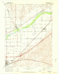
1951 Map of Brush East
USGS Topo · Published 1972About this map
Agricultural and industrial life in eastern Morgan County is defined by the vital waters of the South Platte River and the complex irrigation network that supports it. This 1951 survey reveals the infrastructure of the Missouri River Basin development, highlighted by the massive Sugar Refinery and Sub Station near the town of Brush. The landscape is a grid of productivity, where the Lower Platte and Beaver Canal and Snyder Ditch divert water to the surrounding plains. The settlement patterns follow the steel of the Union Pacific and Burlington Northern railroads, which connect small communities like Hillrose, Snyder, and Camden. Rural education is marked by the presence of the Colwell School and Fairview School, serving a territory dotted with windmills and cattle operations like the Trowel Ranch. The map captures a high-water mark of mid-century prairie engineering, from the Sewage Disposal Plant to the Municipal Airport.
Find a feature on this map
22 named features on this map. Tap any name to fly to it.
Don’t see what you’re looking for? This feature index may not catch every label — zoom into the map to look around manually.
Map Details
Editions of this 1951 Brush East Map
4 editions found
Other maps of this area

1951 · Dead Horse Springs
USGS Topo · 1:24,000

1951 · Messex
USGS Topo · 1:24,000

1951 · Brush West
USGS Topo · 1:24,000

1951 · Antelope Springs
USGS Topo · 1:24,000

1951 · Merino SW
USGS Topo · 1:24,000

1951 · Brush East
USGS Topo · 1:24,000

1954 · Sterling
USGS Topo · 1:250,000

1958 · Sterling
USGS Topo · 1:250,000

1963 · Round Top
USGS Topo · 1:24,000

1965 · Miller Ranch
USGS Topo · 1:24,000