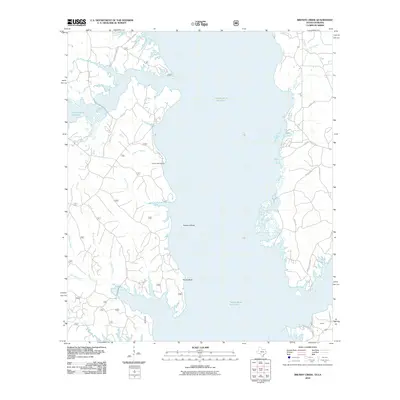
2010 Map of Brushy Creek
USGS Topo · Published 2010About this map
Toledo Bend Reservoir dominates this landscape along the Texas-Louisiana border, where the inundated valley of the Sabine River creates a complex system of inlets and peninsulas. The 2010 geography reveals the intricate shoreline around Buzzard Bend and Silvie Bend, showing how the reservoir transformed former creek bottoms into navigable waterways. Inland, a network of timber and access roads like 147 Forestry Rd and Fanchers Landing Rd weave through the forest, serving the rural community and recreational traffic. On the Louisiana side, the settlement of Ebarb sits near the water, while numerous named drainages such as Brushy Creek, Yellow Branch, and McGrue Creek illustrate the original drainage pattern before the damming of the river. This map serves as a detailed record of water access points, including Snyders Boat Ramp, reflecting the area's transition into a major regional destination for fishing and outdoor life.
Find a feature on this map
29 named features on this map. Tap any name to fly to it.
Don’t see what you’re looking for? This feature index may not catch every label — zoom into the map to look around manually.
Map Details
Editions of this 2010 Brushy Creek Map
This is the sole edition of this map. No revisions or reprints were ever made.
Other maps of this area

1941 · Zwolle
USGS Topo · 1:62,500

1941 · Pelican
USGS Topo · 1:62,500

1943 · Pleasant Hill
USGS Topo · 1:62,500

1944 · Logansport
USGS Topo · 1:62,500

1944 · Patroon
USGS Topo · 1:62,500

1944 · Zwolle
USGS Topo · 1:62,500

1944 · Pleasant Hill
USGS Topo · 1:62,500

1953 · Alexandria
USGS Topo · 1:250,000

1955 · Alexandria
USGS Topo · 1:250,000

1956 · Logansport
USGS Topo · 1:62,500