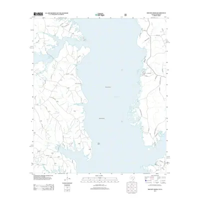
2013 Map of Brushy Creek
USGS Topo · Published 2013About this map
Toledo Bend Reservoir dominates this landscape along the Texas-Louisiana border, defining the jagged western shoreline of the Sabine River basin. The map detail highlights several prominent water features that feed into the reservoir, including Brushy Cr, Bowen Br, and Yellow Br. On the Louisiana side, the community of Ebarb is visible in the southeastern corner, serving as a rare inland node in a region otherwise characterized by timberland and seasonal waterfront access. The terrain is marked by distinctive geographical points like Browns Bend, Buzzard Bend, and Silvie Bend, which illustrate the complex flooding patterns of the reservoir. A network of forest service and county roads, such as MR Sanders Rd and Boucher Rd, provides access to the shoreline and higher elevations like Royal Ridge. Local access to the water is facilitated by landmarks like Snyders Boat Ramp, reflecting the area's modern reliance on the reservoir for recreation and local industry.
Find a feature on this map
60 named features on this map. Tap any name to fly to it.
Don’t see what you’re looking for? This feature index may not catch every label — zoom into the map to look around manually.
Map Details
Editions of this 2013 Brushy Creek Map
This is the sole edition of this map. No revisions or reprints were ever made.
Other maps of this area

1941 · Zwolle
USGS Topo · 1:62,500

1941 · Pelican
USGS Topo · 1:62,500

1943 · Pleasant Hill
USGS Topo · 1:62,500

1944 · Logansport
USGS Topo · 1:62,500

1944 · Patroon
USGS Topo · 1:62,500

1944 · Zwolle
USGS Topo · 1:62,500

1944 · Pleasant Hill
USGS Topo · 1:62,500

1953 · Alexandria
USGS Topo · 1:250,000

1955 · Alexandria
USGS Topo · 1:250,000

1956 · Logansport
USGS Topo · 1:62,500