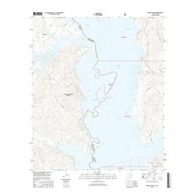
2016 Map of Brushy Creek
USGS Topo · Published 2016About this map
Huxley sits on the western shore of the Toledo Bend Reservoir, where the state line between Texas and Louisiana follows the submerged channel of the Sabine River. The terrain is defined by the extensive backwaters and wetlands of the Sabine National Forest, including numerous named sloughs such as Soto Saline Slough, Tiger Lake Slough, and Charley Buck Slough. This landscape reveals a complex network of bayous and creeks, including Bayou Blue and Brushy Creek, which drain into the reservoir.
Find a feature on this map
49 named features on this map. Tap any name to fly to it.
Don’t see what you’re looking for? This feature index may not catch every label — zoom into the map to look around manually.
Map Details
Editions of this 2016 Brushy Creek Map
This is the sole edition of this map. No revisions or reprints were ever made.
Other maps of this area

1941 · Zwolle
USGS Topo · 1:62,500

1941 · Pelican
USGS Topo · 1:62,500

1943 · Pleasant Hill
USGS Topo · 1:62,500

1944 · Logansport
USGS Topo · 1:62,500

1944 · Patroon
USGS Topo · 1:62,500

1944 · Zwolle
USGS Topo · 1:62,500

1944 · Pleasant Hill
USGS Topo · 1:62,500

1953 · Alexandria
USGS Topo · 1:250,000

1955 · Alexandria
USGS Topo · 1:250,000

1956 · Logansport
USGS Topo · 1:62,500