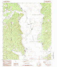
1984 Map of Brushy Creek
USGS Topo · Published 1984About this map
The Sabine River serves as the central artery and state boundary in this mid-1980s provisional study, where the waters of the Toledo Bend Reservoir dominate the landscape. To the west, the Sabine National Forest covers much of the Texas side, showing a complex network of drainage features like Brushy Creek and Blue Bayou. The map illustrates the specialized shoreline geography created by the reservoir's inundation, specifically at Ragtown Bay and English Bay.
Find a feature on this map
25 named features on this map. Tap any name to fly to it.
Don’t see what you’re looking for? This feature index may not catch every label — zoom into the map to look around manually.
Map Details
Editions of this 1984 Brushy Creek Map
This is the sole edition of this map. No revisions or reprints were ever made.
Other maps of this area

1941 · Zwolle
USGS Topo · 1:62,500

1941 · Pelican
USGS Topo · 1:62,500

1943 · Pleasant Hill
USGS Topo · 1:62,500

1944 · Logansport
USGS Topo · 1:62,500

1944 · Patroon
USGS Topo · 1:62,500

1944 · Zwolle
USGS Topo · 1:62,500

1944 · Pleasant Hill
USGS Topo · 1:62,500

1953 · Alexandria
USGS Topo · 1:250,000

1955 · Alexandria
USGS Topo · 1:250,000

1956 · Logansport
USGS Topo · 1:62,500