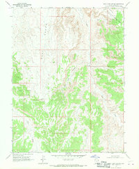
1968 Map of Buck Camp Canyon
USGS Topo · Published 1970About this map
Industrial development and energy extraction define this 1968 landscape in Uintah County, where the Buck Canyon Gas Field and Rock House Gas Field sprawl across the high desert terrain. The map documents a technical environment of production, featuring an Aboveground Pipeline, multiple Gas Wells, and remote Drill Holes scattered among the deep ravines.
Find a feature on this map
15 named features on this map. Tap any name to fly to it.
Don’t see what you’re looking for? This feature index may not catch every label — zoom into the map to look around manually.
Map Details
Editions of this 1968 Buck Camp Canyon Map
2 editions found
Other maps of this area

1885 · East Tavaputs
USGS Topo · 1:250,000

1956 · Grand Junction
USGS Topo · 1:250,000

1959 · Grand Junction
USGS Topo · 1:250,000

1960 · Grand Junction
USGS Topo · 1:250,000

1962 · Grand Junction
USGS Topo · 1:250,000

1964 · Grand Junction
USGS Topo · 1:250,000

1965 · Grand Junction
USGS Topo · 1:250,000

1966 · Bates Knolls
USGS Topo · 1:24,000
1966 · Agency Draw NE
USGS Topo · 1:24,000
1966 · Copper Canyon
USGS Topo · 1:24,000