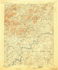
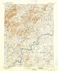
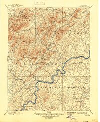
1892 Map of Buckingham
USGS Topo · Published 1929About this map
The James River and its major tributaries, including the Rockfish River and Tye River, carve through the complex topography of central Virginia in this late 19th-century survey. The landscape is defined by the industry of the era, notably the Soap Stone Quarry near Schuyler and a network of water-powered operations such as Faber Mills and Variety Mills. Transportation corridors are well established, with the Virginia Midland Railroad and the Richmond and Alleghany Railroad facilitating movement through the gaps of the Hog Creek Green Mountains and across the river basins. Small rural hubs like Howardsville and Arrington serve as central points for the surrounding agricultural and mountain communities. The map also delineates early forest conservation efforts within the Augusta Natural Bridge National Forest, illustrating the balance between extraction, transport, and the preservation of the Blue Ridge foothills.
Find a feature on this map
162 named features on this map. Tap any name to fly to it.
Don’t see what you’re looking for? This feature index may not catch every label — zoom into the map to look around manually.
Map Details
Editions of this 1892 Buckingham Map
7 editions found
Other maps of this area

1891 · Palmyra
USGS Topo · 1:125,000

1891 · Farmville
USGS Topo · 1:125,000

1892 · Lynchburg
USGS Topo · 1:125,000

1892 · Buckingham
USGS Topo · 1:125,000

1892 · Appomattox
USGS Topo · 1:125,000

1892 · Gordonsville
USGS Topo · 1:125,000

1892 · Harrisonburg
USGS Topo · 1:125,000

1893 · Farmville
USGS Topo · 1:125,000

1894 · Staunton
USGS Topo · 1:125,000

1894 · Lexington
USGS Topo · 1:125,000