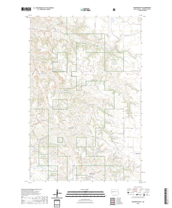
2024 Map of Buckskin Butte
USGS Topo · Published 2024About this map
Grassy Butte sits at the edge of the dissected badlands landscape in McKenzie County, showing the intersection of local ranching life and the protected wilderness of the Little Missouri National Grassland. The terrain is characterized by dramatic elevation changes between the high plateaus of Teepee Butte and the deep drainage basins carved by Cottonwood Creek and Bennett Creek. Modern recreation and traditional land use are visible through the route of the Maah Daah Hey Trl, which winds through the western half of the map, and the Cottonwood Trl following the creek's path. The map provides a look at the township and range survey system, with clear boundaries for t145n r99w and neighboring sections, detailing a rugged landscape defined by its buttes and coulees.
Find a feature on this map
25 named features on this map. Tap any name to fly to it.
Don’t see what you’re looking for? This feature index may not catch every label — zoom into the map to look around manually.
Map Details
Editions of this 2024 Buckskin Butte Map
This is the sole edition of this map. No revisions or reprints were ever made.
Other maps of this area

1953 · Watford City
USGS Topo · 1:250,000

1957 · Watford City
USGS Topo · 1:250,000

1958 · Long X Divide
USGS Topo · 1:24,000

1958 · Sperati Point
USGS Topo · 1:24,000

1958 · Lone Butte
USGS Topo · 1:24,000

1967 · Watford City
USGS Topo · 1:250,000

1974 · Wolf Coulee
USGS Topo · 1:24,000

1974 · Grassy Butte SW
USGS Topo · 1:24,000

1974 · Squaretop Butte
USGS Topo · 1:24,000

1974 · Buckskin Butte
USGS Topo · 1:24,000