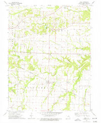
1973 Map of Buell
USGS Topo · Published 1977About this map
Upper Loutre Prairie dominates the northern landscape of this Montgomery County region, where the high, flat ground gives way to a dense network of drainage creeks including Coon Creek and Crooked Creek. The settlement of Buell sits at a strategic junction of the Burlington Northern railroad, while Middletown anchors the northern border near Middletown Lake. For genealogists, the map is a significant record of local family and community history, preserving the locations of McQuoid Cem, Dillon Cem, and White Cem. The rural landscape is further defined by its spiritual centers, such as Trinity Ch and Hopewell Ch, alongside several industrial markers including a Claypit near Elkhorn Creek. The transition from the prairie heights down to the wooded creek bottoms reflects the agricultural and industrial patterns of the early 1970s.
Find a feature on this map
32 named features on this map. Tap any name to fly to it.
Don’t see what you’re looking for? This feature index may not catch every label — zoom into the map to look around manually.
Map Details
Editions of this 1973 Buell Map
2 editions found
Other maps of this area

1890 · Louisiana
USGS Topo · 1:125,000

1890 · Mexico
USGS Topo · 1:125,000

1890 · Hermann
USGS Topo · 1:125,000

1890 · Fulton
USGS Topo · 1:125,000

1940 · Montgomery City
USGS Topo · 1:62,500

1942 · Montgomery City
USGS Topo · 1:62,500

1942 · Wellsville
USGS Topo · 1:62,500

1942 · New Florence
USGS Topo · 1:62,500

1942 · Bellflower
USGS Topo · 1:62,500

1945 · Bellflower
USGS Topo · 1:62,500