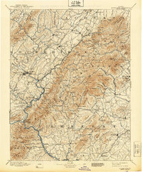
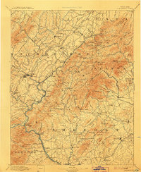
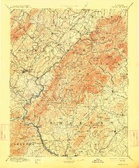
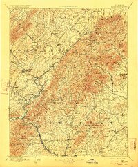
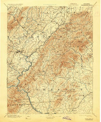
1894 Map of Buena Vista
USGS Topo · Published 1939About this map
Lexington and the industrializing river valleys of the Blue Ridge define this late 19th-century survey of central Virginia. The landscape is marked by a transition from the limestone-rich valleys to the high peaks of the George Washington National Forest. Key transportation corridors follow the water, with the Balto. & Ohio R.R. and Chesapeake & Ohio R.R. threading through gaps to connect mountain settlements like Vesuvius and Raphine.
Find a feature on this map
179 named features on this map. Tap any name to fly to it.
Don’t see what you’re looking for? This feature index may not catch every label — zoom into the map to look around manually.
Map Details
Editions of this 1894 Buena Vista Map
7 editions found
Other maps of this area

1890 · Roanoke
USGS Topo · 1:125,000

1891 · Roanoke
USGS Topo · 1:125,000

1892 · Lynchburg
USGS Topo · 1:125,000

1892 · Buckingham
USGS Topo · 1:125,000

1892 · Appomattox
USGS Topo · 1:125,000

1892 · Harrisonburg
USGS Topo · 1:125,000

1894 · Staunton
USGS Topo · 1:125,000

1894 · Natural Bridge
USGS Topo · 1:125,000

1894 · Lexington
USGS Topo · 1:125,000

1894 · Natural Bridge
USGS Topo · 1:62,500