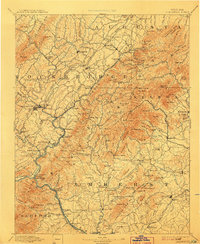
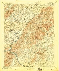
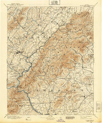
1894 Map of Lexington
USGS Topo · Published 1907About this map
Rockbridge Baths and Vesuvius highlight the diverse settlement patterns of the Blue Ridge foothills during this late nineteenth-century survey. The landscape is defined by the steep ridges of Tobacco Row Mt and Sallings Mtn, with narrow gaps and ferries providing critical passage. Transportation and commerce are centered on the James River corridor, featuring the Rope Ferry Snowden P.O. and Waughes Ford. Industrial and local community markers such as Chalk Mine Mt, Massies Mill, and Cornerstone Ch offer a detailed view of rural Virginia life before the advent of modern highways. The mapping of Amherst Station and the Richmond and Danville railroad tracks the vital connection between these highland communities and the wider regional economy.
Find a feature on this map
202 named features on this map. Tap any name to fly to it.
Don’t see what you’re looking for? This feature index may not catch every label — zoom into the map to look around manually.
Map Details
Editions of this 1894 Lexington Map
7 editions found
Other maps of this area

1890 · Roanoke
USGS Topo · 1:125,000

1891 · Roanoke
USGS Topo · 1:125,000

1892 · Lynchburg
USGS Topo · 1:125,000

1892 · Buckingham
USGS Topo · 1:125,000

1892 · Appomattox
USGS Topo · 1:125,000

1892 · Harrisonburg
USGS Topo · 1:125,000

1894 · Staunton
USGS Topo · 1:125,000

1894 · Natural Bridge
USGS Topo · 1:125,000

1894 · Lexington
USGS Topo · 1:125,000

1894 · Natural Bridge
USGS Topo · 1:62,500