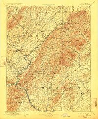
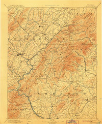
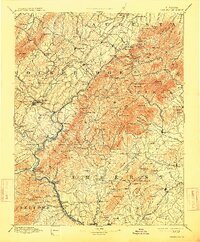
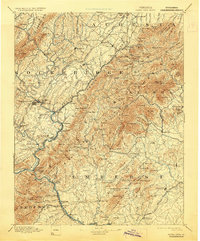
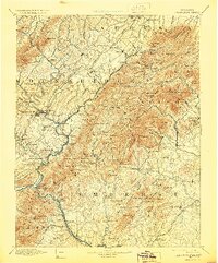
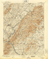
1894 Map of Lexington
USGS Topo · Published 1923About this map
The Maury River and James River converge in this late nineteenth-century study of the Blue Ridge foothills, where early industrial sites and mountain gaps defined the movement of goods and people. At the southern edge of the sheet, Rope Ferry (Snowden P.O.) and Big Island mark critical crossing points along the river corridor, while the Richmond and Alleghany R.R. follows the water's path through the mountains. Further north, the landscape is dotted with small industrial and agricultural centers like Buffalo Forge and Buffalo Mills, which relied on the numerous creeks draining the eastern slopes of the range.
Find a feature on this map
164 named features on this map. Tap any name to fly to it.
Don’t see what you’re looking for? This feature index may not catch every label — zoom into the map to look around manually.
Map Details
Editions of this 1894 Lexington Map
7 editions found
Other maps of this area

1890 · Roanoke
USGS Topo · 1:125,000

1891 · Roanoke
USGS Topo · 1:125,000

1892 · Lynchburg
USGS Topo · 1:125,000

1892 · Buckingham
USGS Topo · 1:125,000

1892 · Appomattox
USGS Topo · 1:125,000

1892 · Harrisonburg
USGS Topo · 1:125,000

1894 · Staunton
USGS Topo · 1:125,000

1894 · Natural Bridge
USGS Topo · 1:125,000

1894 · Lexington
USGS Topo · 1:125,000

1894 · Natural Bridge
USGS Topo · 1:62,500