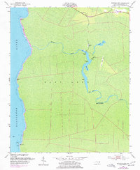
1953 Map of Buffalo City
USGS Topo · Published 1977About this map
Buffalo City and the surrounding marshlands of East Lake define this 1953 survey, which was later photorevised in the mid-1970s. The map captures a landscape dominated by the winding path of Milltail Creek as it feeds into the Alligator River. While once a bustling lumber town, the area is shown here with numerous Ruins and Piling labels near Buzzard Roost, marking the remnants of former industry along the water's edge.
Find a feature on this map
26 named features on this map. Tap any name to fly to it.
Don’t see what you’re looking for? This feature index may not catch every label — zoom into the map to look around manually.
Map Details
Editions of this 1953 Buffalo City Map
3 editions found
Other maps of this area

1943 · Columbia
USGS Topo · 1:125,000

1943 · Roanoke Island
USGS Topo · 1:125,000

1953 · Engelhard NW
USGS Topo · 1:24,000

1953 · Buffalo City
USGS Topo · 1:24,000

1953 · Fairfield NE
USGS Topo · 1:24,000

1953 · East Lake SE
USGS Topo · 1:24,000

1953 · Manns Harbor
USGS Topo · 1:24,000
1953 · East Lake
USGS Topo · 1:24,000

1953 · Engelhard NE
USGS Topo · 1:24,000

1953 · Frying Pan
USGS Topo · 1:24,000