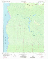
1953 Map of Buffalo City
USGS Topo · Published 1989About this map
Buffalo City sits surrounded by the intricate wetlands of Dare County, where the Milltail Creek drainage network meets the wide expanse of the Alligator River. This 1953 survey, photo-inspected in 1980, reveals a landscape defined by water and low-lying topography, featuring a complex system of guts and bays like Sandy Ridge Gut and Boat Bay. The presence of Ruins and Piling near the creek suggest a history of human activity and industry along these waterways, while the Lookout Tower near East Lake provides a terrestrial landmark in the marshy terrain.
Find a feature on this map
24 named features on this map. Tap any name to fly to it.
Don’t see what you’re looking for? This feature index may not catch every label — zoom into the map to look around manually.
Map Details
Editions of this 1953 Buffalo City Map
3 editions found
Other maps of this area

1943 · Columbia
USGS Topo · 1:125,000

1943 · Roanoke Island
USGS Topo · 1:125,000

1953 · Engelhard NW
USGS Topo · 1:24,000

1953 · Buffalo City
USGS Topo · 1:24,000

1953 · Fairfield NE
USGS Topo · 1:24,000

1953 · East Lake SE
USGS Topo · 1:24,000

1953 · Manns Harbor
USGS Topo · 1:24,000
1953 · East Lake
USGS Topo · 1:24,000

1953 · Engelhard NE
USGS Topo · 1:24,000

1953 · Frying Pan
USGS Topo · 1:24,000