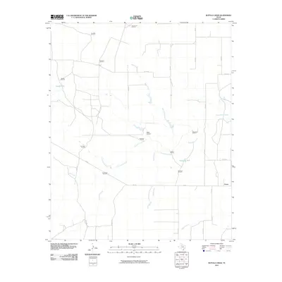
2010 Map of Buffalo Creek
USGS Topo · Published 2010About this map
The North Wichita River meanders through this portion of King County, defining a landscape shaped by water management in a semi-arid ranching environment. Settled at the junction of FM 193 and several county roads, Finney serves as the primary named community in this territory. The area is marked by a sophisticated network of water infrastructure, including numerous family-named windmills and tanks used to sustain local livestock. Named features such as Sweetness Windmill, Doc Green Windmill, and SnakeyFutch Windmill speak to the deep-rooted ranching heritage of the Texas Panhandle region.
Find a feature on this map
44 named features on this map. Tap any name to fly to it.
Don’t see what you’re looking for? This feature index may not catch every label — zoom into the map to look around manually.
Map Details
Editions of this 2010 Buffalo Creek Map
This is the sole edition of this map. No revisions or reprints were ever made.
Other maps of this area

1954 · Lubbock
USGS Topo · 1:250,000

1967 · Guthrie NW
USGS Topo · 1:24,000

1967 · Fourmile Hill
USGS Topo · 1:24,000

1968 · Grow
USGS Topo · 1:24,000

1968 · Buffalo Creek
USGS Topo · 1:24,000

1968 · Grow NW
USGS Topo · 1:24,000

1968 · Dumont
USGS Topo · 1:24,000
1968 · Ginsite
USGS Topo · 1:24,000

1968 · China Canyon
USGS Topo · 1:24,000

1968 · East Afton NE
USGS Topo · 1:24,000