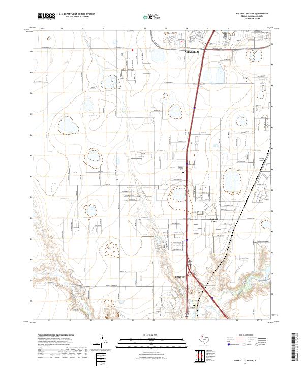
2022 Map of Buffalo Stadium
USGS Topo · Published 2022About this map
The transition between the urban reach of Amarillo and the university town of Canyon is captured in this modern survey, highlighting the corridor of Randall County. The landscape is defined by the significant hydrological carving of the Prairie Dog Town Fork Red River and Palo Duro Creek at the southern edge, contrasting with the residential and industrial development to the north. Local history is anchored by sites like the Memory Gardens Cem and the T-Anchor Ranch Cem, while transportation and recreation are represented by the Buffalo Airport and Buffalo Stadium Rd. Other notable water features include the seasonal drainage of Spring Draw and the isolated Frog Lake. The map illustrates how modern suburban growth like Rockwell Place integrates with traditional Texas panhandle ranching terrain and drainage basins.
Find a feature on this map
22 named features on this map. Tap any name to fly to it.
Don’t see what you’re looking for? This feature index may not catch every label — zoom into the map to look around manually.
Map Details
Editions of this 2022 Buffalo Stadium Map
This is the sole edition of this map. No revisions or reprints were ever made.
Other maps of this area

1954 · Tucumcari
USGS Topo · 1:250,000

1954 · Amarillo
USGS Topo · 1:250,000

1954 · Plainview
USGS Topo · 1:250,000

1954 · Clovis
USGS Topo · 1:250,000

1956 · Amarillo East
USGS Topo · 1:24,000

1958 · Clovis
USGS Topo · 1:250,000

1958 · Amarillo
USGS Topo · 1:250,000

1958 · Tucumcari
USGS Topo · 1:250,000

1958 · Plainview
USGS Topo · 1:250,000

1960 · Canyon
USGS Topo · 1:62,500