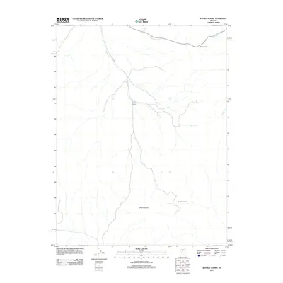
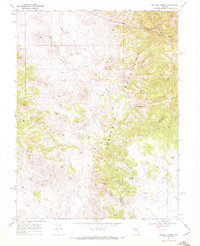
2011 Map of Buffalo Summit
USGS Topo · Published 2011About this map
Buffalo Mountain and the high point at Buffalo Summit define the drainage patterns of this high-altitude landscape in Churchill County. The terrain is marked by steep seasonal watercourses, including the network of Buffalo Creek and the southern descent of Buffalo Canyon. In the northern portion of the quadrangle, Road Canyon Creek flows through the area near Skull Canyon, tracing a narrow path through the interior. This survey by the U.S. Geological Survey demonstrates the sparse infrastructure of the region, where natural topography and elevation are the primary landmarks. The map documents the existing road network as it navigated the complex drainage systems of these basins at the start of the 21st century.
Find a feature on this map
6 named features on this map. Tap any name to fly to it.
Don’t see what you’re looking for? This feature index may not catch every label — zoom into the map to look around manually.
Map Details
Editions of this 2011 Buffalo Summit Map
This is the sole edition of this map. No revisions or reprints were ever made.
Other maps of this area

1955 · Millett
USGS Topo · 1:250,000

1956 · South Shoshone Peak
USGS Topo · 1:62,500

1959 · Millett
USGS Topo · 1:250,000
1969 · Quartz Mtn
USGS Topo · 1:24,000
1969 · Quartzite Mtn NW
USGS Topo · 1:24,000

1969 · Desatoya Peak
USGS Topo · 1:24,000

1969 · Carroll Summit
USGS Topo · 1:24,000

1969 · Eastgate
USGS Topo · 1:24,000
1969 · Burnt Cabin Summit
USGS Topo · 1:24,000
1969 · Buffalo Summit
USGS Topo · 1:24,000