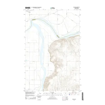
2014 Map of Buford
USGS Topo · Published 2014About this map
The Missouri River and Yellowstone River converge in this western North Dakota landscape, marking a significant hydrologic junction at the border of Williams and McKenzie counties. The settlement of Buford sits on the northern bank of the Missouri, positioned near the historic confluence where the two major rivers meet. To the east, the waters transition into the western reaches of Lake Sakakawea, while the surrounding terrain is defined by the dissection of Briar Cr and the presence of Nohly Lake. A structured grid of rural roads, including 153rd Ave NW and 40th St NW, provides access to the agricultural benchlands and river bottoms that dominate the area. The map illustrates the contemporary relationship between these powerful waterways and the local road network in a region defined by its river-focused geography.
Find a feature on this map
30 named features on this map. Tap any name to fly to it.
Don’t see what you’re looking for? This feature index may not catch every label — zoom into the map to look around manually.
Map Details
Editions of this 2014 Buford Map
This is the sole edition of this map. No revisions or reprints were ever made.
Other maps of this area

1909 · Glendive
USGS Topo · 1:250,000

1953 · Williston
USGS Topo · 1:250,000

1953 · Watford City
USGS Topo · 1:250,000

1954 · Glendive
USGS Topo · 1:250,000

1954 · Wolf Point
USGS Topo · 1:250,000

1957 · Glendive
USGS Topo · 1:250,000

1957 · Williston
USGS Topo · 1:250,000

1957 · Watford City
USGS Topo · 1:250,000

1958 · Wolf Point
USGS Topo · 1:250,000

1958 · Glendive
USGS Topo · 1:250,000