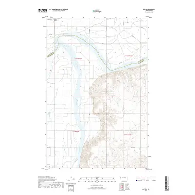
2017 Map of Buford
USGS Topo · Published 2017About this map
The Yellowstone River converges with the Missouri River in this western North Dakota landscape, a confluence that has historically served as a critical geographic marker for travelers and traders. The small settlement of Buford sits just north of this junction, positioned along the edge of the river valley. The topography is sharply divided between the wide, level floodplains of the river bottoms and the intricate network of breaks and draws to the south and east. Modern infrastructure, such as Co Rd 16 and 157th Ave NW, follows the sectional grid through the flatter agricultural lands, while the southern reach of the map reveals the rugged drainage of Briar Cr and the western tip of Lake Sakakawea. Further west, Nohly Lake marks the transition toward the Montana border.
Find a feature on this map
25 named features on this map. Tap any name to fly to it.
Don’t see what you’re looking for? This feature index may not catch every label — zoom into the map to look around manually.
Map Details
Editions of this 2017 Buford Map
This is the sole edition of this map. No revisions or reprints were ever made.
Other maps of this area

1909 · Glendive
USGS Topo · 1:250,000

1953 · Williston
USGS Topo · 1:250,000

1953 · Watford City
USGS Topo · 1:250,000

1954 · Glendive
USGS Topo · 1:250,000

1954 · Wolf Point
USGS Topo · 1:250,000

1957 · Glendive
USGS Topo · 1:250,000

1957 · Williston
USGS Topo · 1:250,000

1957 · Watford City
USGS Topo · 1:250,000

1958 · Wolf Point
USGS Topo · 1:250,000

1958 · Glendive
USGS Topo · 1:250,000