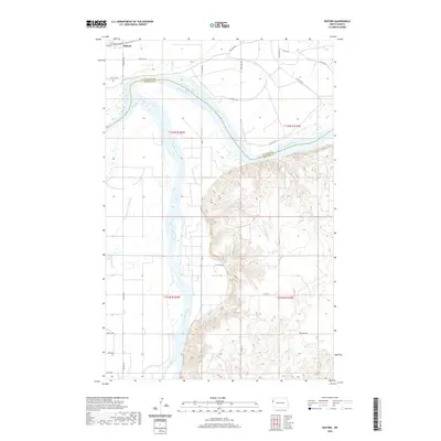
2020 Map of Buford
USGS Topo · Published 2020About this map
The confluence of the Missouri River and the Yellowstone River anchors this North Dakota landscape, marking the historic boundary between Williams Co and McKenzie Co. This modern survey documents the high plains terrain where the Missouri begins to widen into the headwaters of Lake Sakakawea. The small settlement of Buford sits near the river bend, surrounded by a grid of county roads such as 143rd Ave NW and 40th St NW. The map reveals the deeply etched drainage of Briar Cr cutting through the bluffs south of the river, showing the contrast between the flat river bottoms and the broken upland terrain that characterizes this part of the northern plains.
Find a feature on this map
25 named features on this map. Tap any name to fly to it.
Don’t see what you’re looking for? This feature index may not catch every label — zoom into the map to look around manually.
Map Details
Editions of this 2020 Buford Map
This is the sole edition of this map. No revisions or reprints were ever made.
Other maps of this area

1909 · Glendive
USGS Topo · 1:250,000

1953 · Williston
USGS Topo · 1:250,000

1953 · Watford City
USGS Topo · 1:250,000

1954 · Glendive
USGS Topo · 1:250,000

1954 · Wolf Point
USGS Topo · 1:250,000

1957 · Glendive
USGS Topo · 1:250,000

1957 · Williston
USGS Topo · 1:250,000

1957 · Watford City
USGS Topo · 1:250,000

1958 · Wolf Point
USGS Topo · 1:250,000

1958 · Glendive
USGS Topo · 1:250,000