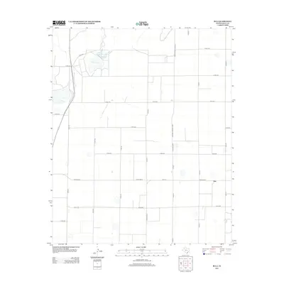
2012 Map of Bula
USGS Topo · Published 2012About this map
The settlement of Bula sits at the intersection of a vast grid of section roads and rural thoroughfares in the High Plains of West Texas. This landscape is defined by its playa lakes, including Upper Pauls Lake, Lower Pauls Lake, and Lower Goose Lake, which serve as critical catchment basins for the surrounding agricultural lands. The map details a dense network of county roads, such as Co RD-1232 and Co RD-175, supporting the local cotton and grain economies. Major transport routes like Ranch Road 37 and Farm-To-Market Road 3397 provide the primary connections through this area of Bailey County, while the numerous smaller routes highlight the systematic parceling of the land for cultivation.
Find a feature on this map
27 named features on this map. Tap any name to fly to it.
Don’t see what you’re looking for? This feature index may not catch every label — zoom into the map to look around manually.
Map Details
Editions of this 2012 Bula Map
This is the sole edition of this map. No revisions or reprints were ever made.
Other maps of this area

1954 · Clovis
USGS Topo · 1:250,000

1954 · Brownfield
USGS Topo · 1:250,000

1958 · Brownfield
USGS Topo · 1:250,000

1958 · Clovis
USGS Topo · 1:250,000

1962 · Brownfield
USGS Topo · 1:250,000

1962 · Needmore
USGS Topo · 1:24,000

1962 · Baileyboro
USGS Topo · 1:24,000

1962 · Sudan
USGS Topo · 1:24,000

1964 · Pep
USGS Topo · 1:24,000
1964 · Beck
USGS Topo · 1:24,000