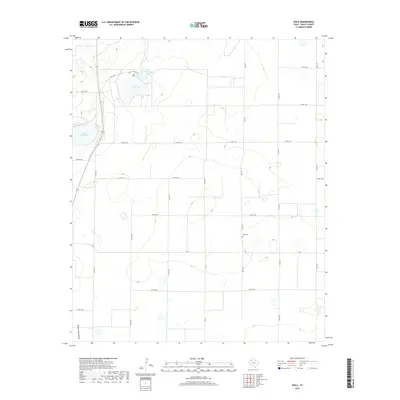
2019 Map of Bula
USGS Topo · Published 2019About this map
Upper Pauls Lake and Lower Pauls Lake dominate the northern landscape of this Bailey County region, part of a distinctive alkaline lake system on the Llano Estacado. The terrain is defined by these shallow depressions and the winding path of Yellow House Draw, an ancient drainage feature that cuts through the southern portion of the quadrangle. The 2019 survey illustrates a highly organized grid of county roads, such as Co RD 1243 and Co RD 227, which facilitate the agricultural life of the area. For those tracing local heritage, the Bula Cem stands as a primary landmark for the community, situated near the intersection of FM 3397 and Co RD 1264. The inclusion of the Paul's Lake Trail provides a rare look at recreational or access paths amidst the expansive farm and ranch lands.
Find a feature on this map
25 named features on this map. Tap any name to fly to it.
Don’t see what you’re looking for? This feature index may not catch every label — zoom into the map to look around manually.
Map Details
Editions of this 2019 Bula Map
This is the sole edition of this map. No revisions or reprints were ever made.
Other maps of this area

1954 · Clovis
USGS Topo · 1:250,000

1954 · Brownfield
USGS Topo · 1:250,000

1958 · Brownfield
USGS Topo · 1:250,000

1958 · Clovis
USGS Topo · 1:250,000

1962 · Brownfield
USGS Topo · 1:250,000

1962 · Needmore
USGS Topo · 1:24,000

1962 · Baileyboro
USGS Topo · 1:24,000

1962 · Sudan
USGS Topo · 1:24,000

1964 · Pep
USGS Topo · 1:24,000
1964 · Beck
USGS Topo · 1:24,000