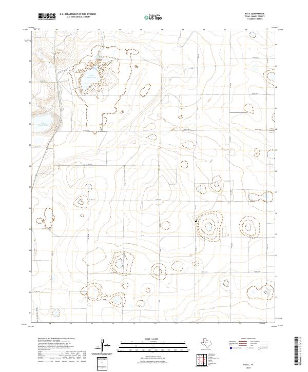
2022 Map of Bula
USGS Topo · Published 2022About this map
Bula Cem sits at the center of this Bailey County landscape, serving as a quiet focal point for a region defined by its distinct ephemeral basins and a rigid network of rural county roads. The terrain is characterized by large, shallow depressions including Upper Pauls Lake, Lower Pauls Lake, and Lower Goose Lake, which punctuate the High Plains surface. In the southwest corner, the Yellow House Draw cuts through the area, representing a significant topographical feature in an otherwise strictly surveyed grid of agricultural land and ranching corridors. The infrastructure follows a predictable pattern of Farm to Market Roads like FM 3397 and FM 54, connecting scattered homesteads to the wider county network during this contemporary era of West Texas land management.
Find a feature on this map
24 named features on this map. Tap any name to fly to it.
Don’t see what you’re looking for? This feature index may not catch every label — zoom into the map to look around manually.
Map Details
Editions of this 2022 Bula Map
This is the sole edition of this map. No revisions or reprints were ever made.
Other maps of this area

1954 · Clovis
USGS Topo · 1:250,000

1954 · Brownfield
USGS Topo · 1:250,000

1958 · Brownfield
USGS Topo · 1:250,000

1958 · Clovis
USGS Topo · 1:250,000

1962 · Brownfield
USGS Topo · 1:250,000

1962 · Needmore
USGS Topo · 1:24,000

1962 · Baileyboro
USGS Topo · 1:24,000

1962 · Sudan
USGS Topo · 1:24,000

1964 · Pep
USGS Topo · 1:24,000
1964 · Beck
USGS Topo · 1:24,000