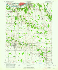
1963 Map of Bunker Hill
USGS Topo · Published 1976About this map
Bunker Hill sits at the heart of this Miami County landscape, where the confluence of several rail lines shaped the early 1960s local economy. The northern reaches are dominated by the city of Peru, situated along the Wabash River and featuring landmarks like the Maconaquah Park and the historic Frances Slocum Trail. Farther south, the transition from urban industry to rural agricultural life is evidenced by the numerous cemeteries and country churches, such as Salem Ch and Emmanuel Ch, that dot the township lines. The influence of mid-century transportation and recreation is visible in the presence of a Drive-in Theater near South Peru and a Drag Strip located near the southern boundary of the quadrangle. Significant watercourses like Pipe Creek and the Mississinewa River provide a geographic framework for the small settlements of Loree and McGrawsville.
Find a feature on this map
68 named features on this map. Tap any name to fly to it.
Don’t see what you’re looking for? This feature index may not catch every label — zoom into the map to look around manually.
Map Details
Editions of this 1963 Bunker Hill Map
4 editions found
Other maps of this area

1951 · Peru
USGS Topo · 1:24,000

1951 · Onward
USGS Topo · 1:24,000

1951 · Twelve Mile
USGS Topo · 1:24,000

1951 · Bunker Hill
USGS Topo · 1:24,000

1951 · Richvalley
USGS Topo · 1:24,000

1953 · Peoria
USGS Topo · 1:24,000

1953 · Danville
USGS Topo · 1:250,000

1953 · Muncie
USGS Topo · 1:250,000

1955 · Danville
USGS Topo · 1:250,000

1956 · Muncie
USGS Topo · 1:250,000