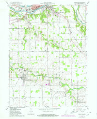
1963 Map of Bunker Hill
USGS Topo · Published 1980About this map
Wabash River and Mississinewa River define the northern landscape of this Miami County region, framing the residential expansion of South Peru and Park View Heights. The topographic detail records a mix of civic infrastructure and recreational transition, from the Maconaquah Park golf course to the Sewage Disposal plant. Further south, the settlement of Bunker Hill serves as a hub for the surrounding agricultural townships, connected by the Chesapeake and Ohio RR and Conrail lines.
Find a feature on this map
50 named features on this map. Tap any name to fly to it.
Don’t see what you’re looking for? This feature index may not catch every label — zoom into the map to look around manually.
Map Details
Editions of this 1963 Bunker Hill Map
4 editions found
Other maps of this area

1951 · Peru
USGS Topo · 1:24,000

1951 · Onward
USGS Topo · 1:24,000

1951 · Twelve Mile
USGS Topo · 1:24,000

1951 · Bunker Hill
USGS Topo · 1:24,000

1951 · Richvalley
USGS Topo · 1:24,000

1953 · Peoria
USGS Topo · 1:24,000

1953 · Danville
USGS Topo · 1:250,000

1953 · Muncie
USGS Topo · 1:250,000

1955 · Danville
USGS Topo · 1:250,000

1956 · Muncie
USGS Topo · 1:250,000