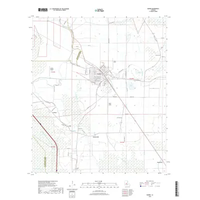
2018 Map of Bunkie
USGS Topo · Published 2018About this map
Bunkie serves as the central hub of this late-2010s survey, situated where the borders of Rapides and Avoyelles Parishes meet. The landscape is defined by an intricate network of waterways, including the winding Bayou Boeuf and the engineered Bayou Boeuf/Cocodrie Diversion Channel. These watercourses, alongside others like Bayou Huffpower and Lac Bon Garçon, reflect the alluvial nature of the region and its historical reliance on natural drainage for agriculture.
Find a feature on this map
83 named features on this map. Tap any name to fly to it.
Don’t see what you’re looking for? This feature index may not catch every label — zoom into the map to look around manually.
Map Details
Editions of this 2018 Bunkie Map
This is the sole edition of this map. No revisions or reprints were ever made.
Other maps of this area

1935 · Turkey Creek
USGS Topo · 1:62,500

1935 · Lecompte
USGS Topo · 1:62,500

1940 · Marksville
USGS Topo · 1:62,500

1948 · Bunkie
USGS Topo · 1:62,500

1949 · Turkey Creek
USGS Topo · 1:62,500

1952 · Lake Charles
USGS Topo · 1:250,000

1953 · Alexandria
USGS Topo · 1:250,000

1954 · Lake Charles
USGS Topo · 1:250,000

1955 · Alexandria
USGS Topo · 1:250,000

1957 · Lecompte
USGS Topo · 1:62,500