
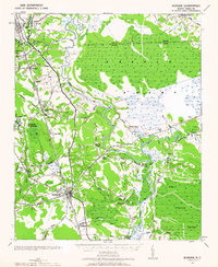
1942 Map of Burgaw
USGS Topo · Published 1942About this map
The Atlantic Coast Line Railroad serves as the industrial spine of this Pender County landscape, connecting agricultural and resettlement communities during the early 1940s. The map illustrates the planned layout of Penderlea Homesteads, a significant New Deal-era subsistence homestead project, alongside the established village of St. Helena, which was founded as a southern European immigrant colony.
Find a feature on this map
53 named features on this map. Tap any name to fly to it.
Don’t see what you’re looking for? This feature index may not catch every label — zoom into the map to look around manually.
Map Details
Editions of this 1942 Burgaw Map
2 editions found
Other maps of this area

1942 · Topsail
USGS Topo · 1:62,500

1943 · Kenansville
USGS Topo · 1:62,500

1947 · Rocky Point
USGS Topo · 1:62,500

1948 · Kenansville
USGS Topo · 1:62,500

1948 · Maple Hill
USGS Topo · 1:62,500

1948 · Topsail
USGS Topo · 1:62,500

1948 · Richlands
USGS Topo · 1:62,500

1953 · Florence
USGS Topo · 1:250,000

1953 · Beaufort
USGS Topo · 1:250,000

1954 · Florence
USGS Topo · 1:250,000