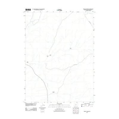
2012 Map of Burley Draw
USGS Topo · Published 2012About this map
Burley Draw serves as a central landmark in this drainage basin within Sweetwater County, where the arid landscape is defined by its intermittent watercourses and technical road networks. This 2012 survey by the U.S. Geological Survey documents the remote terrain where E Salt Wells Cr and Black Butte Cr carve through the basin. The map reveals a high-desert environment characterized by numerous named geographic depressions, including Polly Draw, Cedar Draw, and Scheggs Draw. Human infrastructure in this area is sparse, primarily represented by Patrick Draw Rd and secondary routes that navigate around Alkali Wash. This cartographic record provides a precise view of the hydrology and topographic relief in a region where seasonal runoff shapes the land, making it a valuable resource for understanding the modern geography of Wyoming's high plains.
Find a feature on this map
8 named features on this map. Tap any name to fly to it.
Don’t see what you’re looking for? This feature index may not catch every label — zoom into the map to look around manually.
Map Details
Editions of this 2012 Burley Draw Map
This is the sole edition of this map. No revisions or reprints were ever made.
Other maps of this area

1954 · Rock Springs
USGS Topo · 1:250,000

1958 · Rock Springs
USGS Topo · 1:250,000

1962 · Rock Springs
USGS Topo · 1:250,000
1963 · Potter Mountain
USGS Topo · 1:24,000

1963 · Erickson-Kent Ranch
USGS Topo · 1:24,000

1968 · Cooper Ridge NE
USGS Topo · 1:24,000

1968 · Sand Butte Rim NW
USGS Topo · 1:24,000

1968 · Mud Springs Ranch
USGS Topo · 1:24,000

1968 · Pine Butte
USGS Topo · 1:24,000

1968 · Camel Rock
USGS Topo · 1:24,000