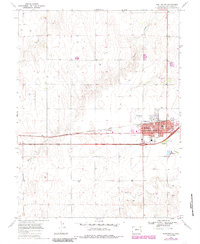
1969 Map of Burlington
USGS Topo · Published 1985About this map
The High Plains hub of Burlington and its nearby counterpart West Burlington serve as the focal point of this Eastern Colorado landscape at the close of the 1960s. The town's layout reflects its dual identity as a transportation and agricultural center, centered on the Chicago Rock Island and Pacific railroad line and the intersection of Highway 70 and Highway 385. Local life is anchored by civic institutions like the High Sch, Hospital, and Fairview Cem, while the Rodeo Ground and Municipal Airport indicate its role as a regional destination.
Find a feature on this map
19 named features on this map. Tap any name to fly to it.
Don’t see what you’re looking for? This feature index may not catch every label — zoom into the map to look around manually.
Map Details
Editions of this 1969 Burlington Map
3 editions found
Other maps of this area

1954 · Limon
USGS Topo · 1:250,000

1957 · Limon
USGS Topo · 1:250,000

1958 · Limon
USGS Topo · 1:250,000

1969 · Settlement
USGS Topo · 1:24,000

1969 · Bethune
USGS Topo · 1:24,000

1969 · Burlington
USGS Topo · 1:24,000

1969 · Mount Sunflower NW
USGS Topo · 1:24,000

1969 · Peconic
USGS Topo · 1:24,000

1969 · Kanorado NW
USGS Topo · 1:24,000

1969 · Burlington 3 NW
USGS Topo · 1:24,000