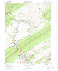
1966 Map of Burnham
USGS Topo · Published 1973About this map
The Kishacoquillas Valley serves as a central corridor of industry and settlement between the ridges of Jacks Mountain and Front Mountain. The Penn Central railroad tracks follow the winding course of Honey Creek through the narrow gap at Mann Narrows, connecting the industrial hubs of Burnham and Yeagertown to the northern settlements of Milroy and Reedsville. This 1960s landscape, with 1973 updates, shows the established manufacturing and transportation infrastructure that sustained Mifflin County, including a Drive-in Theater and the Mifflin County Airport. Local heritage is well-documented through landmarks like the Kishacoquillas High Sch, Alexander Cavern, and several rural burial grounds such as Old Salem Cem and Birch Hill Cem. The map illustrates the transition from the dense forests of Bald Eagle State Forest to the productive agriculture and residential growth found in Lingle Valley and Potlicker Flats.
Find a feature on this map
70 named features on this map. Tap any name to fly to it.
Don’t see what you’re looking for? This feature index may not catch every label — zoom into the map to look around manually.
Map Details
Editions of this 1966 Burnham Map
Other maps of this area

1924 · Centre Hall
USGS Topo · 1:62,500

1924 · Lewistown
USGS Topo · 1:62,500

1925 · Mifflintown
USGS Topo · 1:48,000

1927 · Lewisburg
USGS Topo · 1:62,500

1929 · Centre Hall
USGS Topo · 1:62,500

1934 · Mifflintown
USGS Topo · 1:62,500

1937 · Mifflintown
USGS Topo · 1:62,500

1937 · Millheim
USGS Topo · 1:48,000

1941 · Millheim
USGS Topo · 1:62,500

1943 · Lewistown
USGS Topo · 1:125,000
Featured Places
- Granville Township, PA
- Decatur Township, PA
- Burnham, PA
- Highland Park, Derry Township
- Milroy, Armagh Township