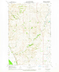
1962 Map of Burnt Butte
USGS Topo · Published 1964About this map
Burnt Butte rises as a prominent landmark in this 1960s landscape north of Bismarck, where the rolling prairie of Burleigh County is deeply incised by the drainages of Burnt Creek and Hay Creek. The area retains a distinctly rural character, defined by section lines and small settlements like Midway and Arnold. A notable detail of the local educational infrastructure is the presence of Burnt Creek Sch No 1, serving the scattered farmsteads of the Glenview and Hay Creek townships. Geologically, the map reveals the region's character through names like Coal Butte and Ball Butte, alongside the presence of Gravel Pits and coulees such as Cave Coulee and Spring Coulee. This survey captures the alignment of Highway 83 as it cuts north through the heart of the territory, providing a precise record of the land use and drainage patterns before further modern expansion.
Find a feature on this map
17 named features on this map. Tap any name to fly to it.
Don’t see what you’re looking for? This feature index may not catch every label — zoom into the map to look around manually.
Map Details
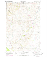
Editions of this 1962 Burnt Butte Map
2 editions found
Other maps of this area

1907 · Bismarck
USGS Topo · 1:125,000

1950 · Wilton
USGS Topo · 1:62,500

1950 · Bismarck
USGS Topo · 1:24,000

1951 · Menoken SW
USGS Topo · 1:24,000

1951 · Bismarck
USGS Topo · 1:62,500

1951 · Mandan
USGS Topo · 1:24,000

1951 · Menoken
USGS Topo · 1:62,500

1954 · Bismarck
USGS Topo · 1:250,000

1954 · McClusky
USGS Topo · 1:250,000

1958 · Bismarck
USGS Topo · 1:250,000