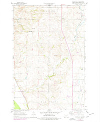
1962 Map of Burnt Butte
USGS Topo · Published 1976About this map
The rolling prairies of Hay Creek and Glenview townships reveal a landscape defined by sharp drainage coulees and isolated topographic rises. The namesake Burnt Butte stands as a prominent landmark in the center of the sheet, while family-named peaks like Ball Butte and Coal Butte rise near the headwaters of Spring Coulee and Cave Coulee. These features reflect the underlying geology of the Missouri Plateau, where water has carved deep paths through the high plains.
Find a feature on this map
15 named features on this map. Tap any name to fly to it.
Don’t see what you’re looking for? This feature index may not catch every label — zoom into the map to look around manually.
Map Details
Editions of this 1962 Burnt Butte Map
2 editions found
Other maps of this area

1907 · Bismarck
USGS Topo · 1:125,000

1950 · Wilton
USGS Topo · 1:62,500

1950 · Bismarck
USGS Topo · 1:24,000

1951 · Menoken SW
USGS Topo · 1:24,000

1951 · Bismarck
USGS Topo · 1:62,500

1951 · Mandan
USGS Topo · 1:24,000

1951 · Menoken
USGS Topo · 1:62,500

1954 · Bismarck
USGS Topo · 1:250,000

1954 · McClusky
USGS Topo · 1:250,000

1958 · Bismarck
USGS Topo · 1:250,000