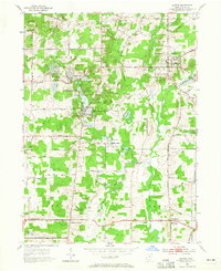
1953 Map of Burton
USGS Topo · Published 1965About this map
Punderson Lake and the surrounding woodlands of Punderson State Park dominate the central landscape of this Geauga County survey. The area exhibits a pattern of small settlements and agricultural crossroads, including Newbury Center, South Newbury, and Welshfield. This region, part of the Connecticut Western Reserve, was divided into townships like Burton, Auburn, and Troy by the Connecticut Land Company, as evidenced by the rectilinear road network and property divisions. Numerous smaller water bodies, such as Kiwanis Lake, Restful Lake, and Lake Kelso, are scattered across the terrain, feeding into larger systems like the Cuyahoga River and Bridge Creek. Local social history is well-preserved through the many family and community cemeteries, including Slitor Cem and Shadyside Cem, alongside landmarks like Troy Sch and Pleasant Hill Ch.
Find a feature on this map
56 named features on this map. Tap any name to fly to it.
Don’t see what you’re looking for? This feature index may not catch every label — zoom into the map to look around manually.
Map Details
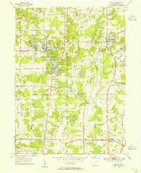
Editions of this 1953 Burton Map
2 editions found
Other maps of this area

1904 · Chardon
USGS Topo · 1:62,500

1905 · Garrettsville
USGS Topo · 1:62,500

1905 · Mentor
USGS Topo · 1:62,500

1906 · Chardon
USGS Topo · 1:62,500

1906 · Chagrin Falls
USGS Topo · 1:62,500

1907 · Garrettsville
USGS Topo · 1:62,500

1907 · Mentor
USGS Topo · 1:62,500

1908 · Chagrin Falls
USGS Topo · 1:62,500

1950 · Cleveland
USGS Topo · 1:250,000

1953 · Chardon
USGS Topo · 1:24,000
Featured Places
- Burton Township, OH
- Burton Village, OH
- Welshfield, Troy Township
- Auburn Township, OH
- Munson Township, OH