
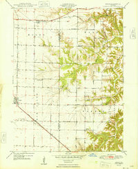
2015 Map of Bushnell East
USGS Topo · Published 2015About this map
Prairie City and Bushnell anchor the western edge of this agricultural corridor along the border of McDonough and Fulton counties. The landscape is defined by the transition from flat prairie farmland to the more dissected drainage basins of the Drowning Fork and the South Fork Shaw Creek. Small rural clusters and burial sites like Checkrow and the nearby Checkrow Cemetery highlight the enduring local geography of the region.
Find a feature on this map
68 named features on this map. Tap any name to fly to it.
Don’t see what you’re looking for? This feature index may not catch every label — zoom into the map to look around manually.
Map Details
Editions of this 2015 Bushnell East Map
This is the sole edition of this map. No revisions or reprints were ever made.
Other maps of this area

1912 · Macomb
USGS Topo · 1:62,500

1914 · Macomb
USGS Topo · 1:62,500

1915 · Avon
USGS Topo · 1:62,500

1916 · Good Hope
USGS Topo · 1:62,500

1918 · Vermont
USGS Topo · 1:62,500

1918 · Good Hope
USGS Topo · 1:62,500

1921 · Vermont
USGS Topo · 1:62,500

1944 · Avon
USGS Topo · 1:62,500

1947 · Adair
USGS Topo · 1:24,000
1948 · Adair
USGS Topo · 1:24,000