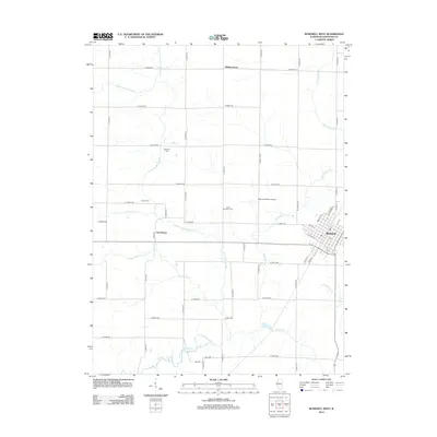
2012 Map of Bushnell West
USGS Topo · Published 2012About this map
Walnut Grove and Scottsburg sit within a landscape defined by the intricate drainage of the La Moine River system in McDonough County. This survey detail highlights the rural character of western Illinois, where family history is anchored by the Solon Robinson Cem, Pearce Cem, and Hageman Cem. The terrain is segmented by a rigid grid of country roads, interrupted only by the meandering paths of Short Fork, Farmers Fork, and the Drowning Fork. To the east, the edge of Bushnell shows a concentrated street plan near the local Po, while the Runyan Aviation Airport provides a distinct landmark in the open fields. The map reveals how the modern agricultural economy overlays a network of creeks like Kepple Cr and S Fork Shaw Cr, preserving the names of early settlers through the various cemeteries and road designations that crisscross the prairie.
Find a feature on this map
49 named features on this map. Tap any name to fly to it.
Don’t see what you’re looking for? This feature index may not catch every label — zoom into the map to look around manually.
Map Details
Editions of this 2012 Bushnell West Map
This is the sole edition of this map. No revisions or reprints were ever made.
Other maps of this area

1912 · Macomb
USGS Topo · 1:62,500

1914 · Macomb
USGS Topo · 1:62,500

1915 · Avon
USGS Topo · 1:62,500

1916 · Good Hope
USGS Topo · 1:62,500

1918 · Vermont
USGS Topo · 1:62,500

1918 · Good Hope
USGS Topo · 1:62,500

1921 · Vermont
USGS Topo · 1:62,500

1944 · Avon
USGS Topo · 1:62,500

1947 · Adair
USGS Topo · 1:24,000
1948 · Adair
USGS Topo · 1:24,000