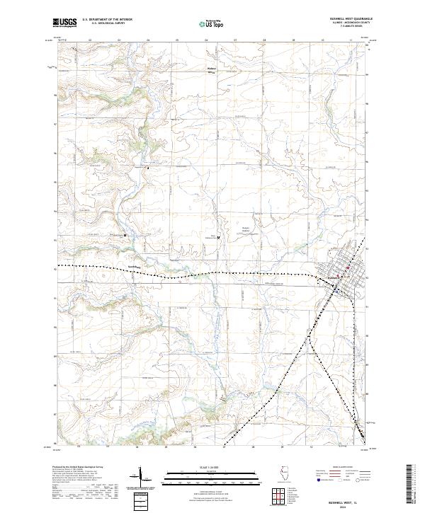
2024 Map of Bushnell West
USGS Topo · Published 2024About this map
The western edges of Bushnell define the eastern margin of this landscape, where the street grid of the town meets the agricultural stretches of McDonough County. This survey highlights the complex drainage systems that feed into the East Fork La Moine River, including the meandering paths of Drowning Fork and Farmers Fork. The terrain is marked by small rural settlements and localized landmarks, such as the Runyan Aviation field and the crossroad community of Scottsburg. For local historians and genealogists, the map preserves the locations of several burial grounds, including the Aberghast Pearce Cem, Hageman Cem, and the Solon Robinson Cem. These cemeteries are often the only remaining markers of the early families who established farms along the North Fork and Short Fork.
Find a feature on this map
76 named features on this map. Tap any name to fly to it.
Don’t see what you’re looking for? This feature index may not catch every label — zoom into the map to look around manually.
Map Details
Editions of this 2024 Bushnell West Map
This is the sole edition of this map. No revisions or reprints were ever made.
Other maps of this area

1912 · Macomb
USGS Topo · 1:62,500

1914 · Macomb
USGS Topo · 1:62,500

1915 · Avon
USGS Topo · 1:62,500

1916 · Good Hope
USGS Topo · 1:62,500

1918 · Vermont
USGS Topo · 1:62,500

1918 · Good Hope
USGS Topo · 1:62,500

1921 · Vermont
USGS Topo · 1:62,500

1944 · Avon
USGS Topo · 1:62,500

1947 · Adair
USGS Topo · 1:24,000
1948 · Adair
USGS Topo · 1:24,000