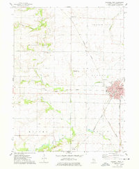
1974 Map of Bushnell West
USGS Topo · Published 1978About this map
The East Fork La Moine River and its tributaries, including Drowning Fork and Farmers Fork, carve a distinct drainage pattern across this Western Illinois landscape. Settlement is concentrated along the historic rail corridors, with the Toledo Peoria and Western and Burlington Northern railroads intersecting at the eastern edge of the quadrangle. The town of Bushnell shows a developed grid with named streets like Twyman St, Jackson St, and Main St, supported by local institutions such as West Sch and High Sch.
Find a feature on this map
37 named features on this map. Tap any name to fly to it.
Don’t see what you’re looking for? This feature index may not catch every label — zoom into the map to look around manually.
Map Details
Editions of this 1974 Bushnell West Map
This is the sole edition of this map. No revisions or reprints were ever made.
Other maps of this area

1912 · Macomb
USGS Topo · 1:62,500

1914 · Macomb
USGS Topo · 1:62,500

1915 · Avon
USGS Topo · 1:62,500

1916 · Good Hope
USGS Topo · 1:62,500

1918 · Vermont
USGS Topo · 1:62,500

1918 · Good Hope
USGS Topo · 1:62,500

1921 · Vermont
USGS Topo · 1:62,500

1944 · Avon
USGS Topo · 1:62,500

1947 · Adair
USGS Topo · 1:24,000
1948 · Adair
USGS Topo · 1:24,000