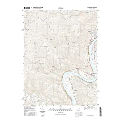
2016 Map of Businessburg
USGS Topo · Published 2016About this map
The Ohio River snakes through the center of this landscape, marking the state boundary between Belmont County, Ohio, and Marshall County, West Virginia. On the eastern shore, the city of Moundsville serves as a major hub, connected to the western bank by the Arch A Moore Bridge and Moundsville Bridge. The riverside economy is evidenced by the presence of McKeefrey and Captina, while the conversion of former industrial or transit corridors is seen in the Glen Dale to Moundsville Rail-Trail.
Find a feature on this map
104 named features on this map. Tap any name to fly to it.
Don’t see what you’re looking for? This feature index may not catch every label — zoom into the map to look around manually.
Map Details
Editions of this 2016 Businessburg Map
This is the sole edition of this map. No revisions or reprints were ever made.
Other maps of this area

1902 · Wheeling
USGS Topo · 1:62,500

1904 · Cameron
USGS Topo · 1:62,500

1905 · Clarington
USGS Topo · 1:62,500

1905 · St. Clairsville
USGS Topo · 1:62,500

1935 · Cameron
USGS Topo · 1:62,500

1935 · Clarington
USGS Topo · 1:62,500

1935 · Wheeling
USGS Topo · 1:62,500

1940 · Clarington
USGS Topo · 1:62,500

1942 · Cameron
USGS Topo · 1:62,500

1942 · Wheeling
USGS Topo · 1:62,500