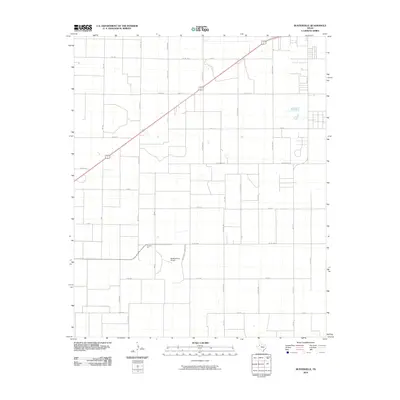
2010 Map of Busterville
USGS Topo · Published 2010About this map
Busters Gin and the McNabb Farm Airport serve as central landmarks in this Lubbock County landscape, where the traditional agricultural economy of the Texas South Plains meets modern aviation. The terrain is defined by an orderly grid of country roads and farm-to-market routes, including Fm 1585 and Fm 179, which facilitate the movement of crops across the level plateau. A series of playfully named thoroughfares such as Rabbit, Tiger, and Yearling provide unique local orientation within the larger network of thoroughfares like Woodrow Rd and Hartland Ave. The map illustrates a transitional phase of development south of Wolfforth, where large-scale farming persists alongside expanding rural residential infrastructure and private airstrips.
Find a feature on this map
40 named features on this map. Tap any name to fly to it.
Don’t see what you’re looking for? This feature index may not catch every label — zoom into the map to look around manually.
Map Details
Editions of this 2010 Busterville Map
This is the sole edition of this map. No revisions or reprints were ever made.
Other maps of this area

1954 · Lubbock
USGS Topo · 1:250,000

1954 · Brownfield
USGS Topo · 1:250,000

1957 · New Home
USGS Topo · 1:62,500

1957 · Lubbock West
USGS Topo · 1:24,000

1957 · Lubbock
USGS Topo · 1:62,500

1957 · Meadow
USGS Topo · 1:62,500

1957 · Wolfforth
USGS Topo · 1:62,500

1958 · Brownfield
USGS Topo · 1:250,000

1962 · Brownfield
USGS Topo · 1:250,000

1976 · Wolfforth SE
USGS Topo · 1:24,000