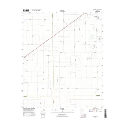
2016 Map of Busterville
USGS Topo · Published 2016About this map
Wolfforth anchors the northeastern corner of this South Plains survey, showing the residential expansion and street grid near Bryan Ave and Aberdeen Ave. The landscape is defined by the convergence of four counties—Hockley, Lubbock, Terry, and Lynn—creating a unique cartographic intersection for regional researchers. To the southwest, the smaller settlement of Busterville sits along the road network, while the Southwest Lubbock Airport provides a key point of infrastructure in the southeastern quadrant. The area is characterized by a dense grid of rural roads, including many named for local flora and fauna such as Quail Rd, Pronghorn, and Koala Rd. This network reveals the systematic organization of the Texas agricultural landscape and the late-20th-century growth patterns extending from the Lubbock metropolitan vicinity.
Find a feature on this map
67 named features on this map. Tap any name to fly to it.
Don’t see what you’re looking for? This feature index may not catch every label — zoom into the map to look around manually.
Map Details
Editions of this 2016 Busterville Map
This is the sole edition of this map. No revisions or reprints were ever made.
Other maps of this area

1954 · Lubbock
USGS Topo · 1:250,000

1954 · Brownfield
USGS Topo · 1:250,000

1957 · New Home
USGS Topo · 1:62,500

1957 · Lubbock West
USGS Topo · 1:24,000

1957 · Lubbock
USGS Topo · 1:62,500

1957 · Meadow
USGS Topo · 1:62,500

1957 · Wolfforth
USGS Topo · 1:62,500

1958 · Brownfield
USGS Topo · 1:250,000

1962 · Brownfield
USGS Topo · 1:250,000

1976 · Wolfforth SE
USGS Topo · 1:24,000