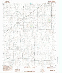
1985 Map of Busterville
USGS Topo · Published 1985About this map
Busterville and the surrounding high plains of West Texas are captured here during a period of transition in the mid-1980s. This survey illustrates a landscape dominated by agriculture and utility infrastructure, where the intersections of Lubbock, Hockley, Terry, and Lynn counties meet. The small community of Wolfforth sits in the northeast corner, while smaller agricultural hubs like Farm Center dot the grid. Modern technological layers are evident through the presence of Radio Towers, a regional Airport, and a prominent Sub Station, reflecting the area's role in supporting the broader Lubbock metropolitan region. The map provides a precise record of rural property boundaries and the network of roads that define the South Plains economy.
Find a feature on this map
11 named features on this map. Tap any name to fly to it.
Don’t see what you’re looking for? This feature index may not catch every label — zoom into the map to look around manually.
Map Details
Editions of this 1985 Busterville Map
This is the sole edition of this map. No revisions or reprints were ever made.
Other maps of this area

1954 · Lubbock
USGS Topo · 1:250,000

1954 · Brownfield
USGS Topo · 1:250,000

1957 · New Home
USGS Topo · 1:62,500

1957 · Lubbock West
USGS Topo · 1:24,000

1957 · Lubbock
USGS Topo · 1:62,500

1957 · Meadow
USGS Topo · 1:62,500

1957 · Wolfforth
USGS Topo · 1:62,500

1958 · Brownfield
USGS Topo · 1:250,000

1962 · Brownfield
USGS Topo · 1:250,000

1976 · Wolfforth SE
USGS Topo · 1:24,000