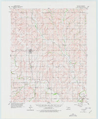
1957 Map of Butler
USGS Topo · Published 1978About this map
The Washita River and its many tributaries, including Barnitz Creek and Soldier Creek, define this central Oklahoma landscape in the late 1950s. The town of Butler serves as a local hub, featuring an Oil Refinery and a Pumping Station that highlight the region's mid-century petroleum industry. Local life is anchored by a dense network of country churches and community centers, such as the Sunnyside Community Hall and Antioch Ch. Transport infrastructure is dominated by the Panhandle and Santa Fe railroad, which parallels the river and connects the smaller settlement of Stafford to the wider rail network. Genealogists will find a wealth of burial sites across the landscape, from the Shiloh Cem in the north to Edwardsville Cem and Valley View Cem further south.
Find a feature on this map
37 named features on this map. Tap any name to fly to it.
Don’t see what you’re looking for? This feature index may not catch every label — zoom into the map to look around manually.
Map Details
Editions of this 1957 Butler Map
2 editions found
Other maps of this area

1955 · Clinton
USGS Topo · 1:250,000

1956 · Cordell
USGS Topo · 1:62,500

1957 · Clinton
USGS Topo · 1:250,000

1957 · Butler
USGS Topo · 1:62,500

1957 · Clinton
USGS Topo · 1:62,500

1957 · Dill City
USGS Topo · 1:62,500

1960 · Hammon
USGS Topo · 1:62,500

1961 · Elk City
USGS Topo · 1:62,500

1961 · Leedey
USGS Topo · 1:62,500

1962 · Putnam
USGS Topo · 1:62,500