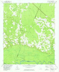
1979 Map of Butlers Bay
USGS Topo · Published 1980About this map
The Santee River forms a wide, meandering boundary at the southern edge of this landscape, separating Williamsburg and Berkeley counties. This lowland region in the late 1970s is characterized by an extensive network of Carolina bays and swampy depressions, including the prominent Butlers Bay and the elongated Hog Meadow Swamp. Local life and travel are anchored by the Seaboard Coast Line Railroad, which cuts a straight path across the northern terrain, and traditional routes like Raccoon Road. Small rural congregations are well-established throughout the area, evidenced by St Lukes Ch, Pine Grove Ch, and Long Branch Ch. Along the river's edge, water features like Broad Lake and Franks Lake highlight the floodplain's complex hydrology, while family landmarks such as Keels Cem provide valuable points of reference for genealogists studying the local families of this riverine territory.
Find a feature on this map
27 named features on this map. Tap any name to fly to it.
Don’t see what you’re looking for? This feature index may not catch every label — zoom into the map to look around manually.
Map Details
Editions of this 1979 Butlers Bay Map
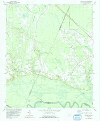
2 editions found
Other maps of this area

1920 · Chicora
USGS Topo · 1:48,000

1920 · Manning
USGS Topo · 1:48,000

1921 · Chicora
USGS Topo · 1:62,500

1921 · Manning
USGS Topo · 1:62,500

1943 · Chicora
USGS Topo · 1:62,500

1943 · Bonneau
USGS Topo · 1:62,500

1944 · Manning
USGS Topo · 1:62,500

1946 · Kingstree
USGS Topo · 1:62,500

1949 · Georgetown
USGS Topo · 1:250,000

1954 · Augusta
USGS Topo · 1:250,000