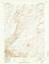
1953 Map of Buzzard Ranch
USGS Topo · Published 1973About this map
Buzzard Ranch sits at the heart of this high-plains landscape in Carbon County, where the ranching economy of the mid-20th century is mapped through its infrastructure of ditches and shearing facilities. The sheep and cattle operations are further evidenced by the Buzzard Ranch Shearing Pens and the outlying Burtch Ranch. In the southern reaches of the quadrangle, the terrain rises sharply into the Ferris Mountains, overlooking the Roberts Ranch (Aband) and a small settlement of Miners near Bear Canyon.
Find a feature on this map
19 named features on this map. Tap any name to fly to it.
Don’t see what you’re looking for? This feature index may not catch every label — zoom into the map to look around manually.
Map Details
Editions of this 1953 Buzzard Ranch Map
3 editions found
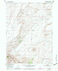
Other maps of this area

1951 · Pathfinder Reservoir NW
USGS Topo · 1:24,000

1951 · Independence Rock
USGS Topo · 1:24,000

1951 · Fort Ridge
USGS Topo · 1:24,000

1953 · Bradley Peak
USGS Topo · 1:24,000

1953 · Seminoe Dam
USGS Topo · 1:24,000

1953 · Ferris
USGS Topo · 1:24,000

1953 · Pathfinder Reservoir SW
USGS Topo · 1:24,000

1953 · Buzzard Ranch
USGS Topo · 1:24,000

1953 · Spanish Mine
USGS Topo · 1:24,000

1955 · Casper
USGS Topo · 1:250,000