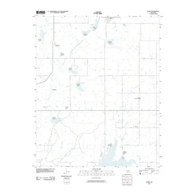
2010 Map of Byars
USGS Topo · Published 2010About this map
Byars sits at the northern edge of this landscape, serving as a hub for a network of rural roads and family cemeteries. The terrain is defined by an extensive water management system, featuring numerous flood control structures such as Peavine Creek Site 5 Dam and Cherokee Sandy Site 4 Dam. These dams dot the courses of Little Peavine Creek, Keel Sandy Creek, and Wolf Creek, creating small reservoirs across the countryside.
Find a feature on this map
42 named features on this map. Tap any name to fly to it.
Don’t see what you’re looking for? This feature index may not catch every label — zoom into the map to look around manually.
Map Details
Editions of this 2010 Byars Map
This is the sole edition of this map. No revisions or reprints were ever made.
Other maps of this area

1898 · Pauls Valley
USGS Topo · 1:125,000

1901 · Stonewall
USGS Topo · 1:125,000

1902 · Pauls Valley
USGS Topo · 1:125,000

1957 · Ardmore
USGS Topo · 1:250,000

1963 · Ardmore
USGS Topo · 1:250,000

1964 · Byars
USGS Topo · 1:24,000

1965 · Pauls Valley NE
USGS Topo · 1:24,000
1965 · Rosedale
USGS Topo · 1:24,000

1965 · Byars SW
USGS Topo · 1:24,000

1965 · Pauls Valley
USGS Topo · 1:24,000