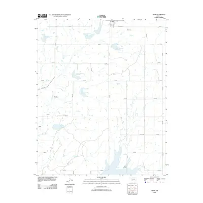
2012 Map of Byars
USGS Topo · Published 2012About this map
The town of Byars serves as the primary hub in this corner of McClain County, anchored by several neighborhood cemeteries that speak to the area’s genealogy. From Byars Cem in the north to Clabber Flats Cem and Abney Cem further south, the landscape is divided by a rigid grid of section roads like N3340 Rd and E1510 Rd. The central geography is defined by the Peavine Creek watershed, which has been extensively managed through a series of numbered reservoirs, including Peavine Creek Site 2 Reservoir and Peavine Creek Site 6 Reservoir.
Find a feature on this map
38 named features on this map. Tap any name to fly to it.
Don’t see what you’re looking for? This feature index may not catch every label — zoom into the map to look around manually.
Map Details
Editions of this 2012 Byars Map
This is the sole edition of this map. No revisions or reprints were ever made.
Other maps of this area

1898 · Pauls Valley
USGS Topo · 1:125,000

1901 · Stonewall
USGS Topo · 1:125,000

1902 · Pauls Valley
USGS Topo · 1:125,000

1957 · Ardmore
USGS Topo · 1:250,000

1963 · Ardmore
USGS Topo · 1:250,000

1964 · Byars
USGS Topo · 1:24,000

1965 · Pauls Valley NE
USGS Topo · 1:24,000
1965 · Rosedale
USGS Topo · 1:24,000

1965 · Byars SW
USGS Topo · 1:24,000

1965 · Pauls Valley
USGS Topo · 1:24,000