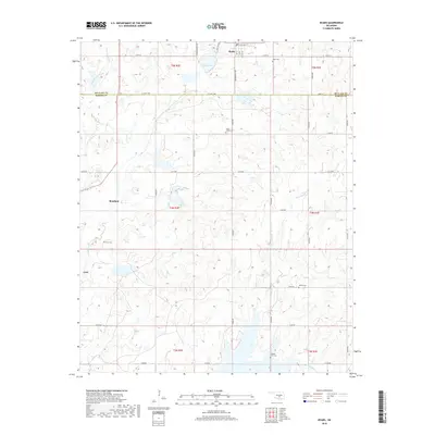
2018 Map of Byars
USGS Topo · Published 2018About this map
The town of Byars sits at the northern edge of this Oklahoma landscape, where the street grid of Williams St and Johnsonville Ave meets the rural expanses along the border of McClain Co and Garvin Co. This 2018 survey reveals a terrain defined by the dendritic drainage patterns of Little Peavine Creek and Wolf Creek, which feed into the broader watershed south toward Keel Sandy Creek.
Find a feature on this map
46 named features on this map. Tap any name to fly to it.
Don’t see what you’re looking for? This feature index may not catch every label — zoom into the map to look around manually.
Map Details
Editions of this 2018 Byars Map
This is the sole edition of this map. No revisions or reprints were ever made.
Other maps of this area

1898 · Pauls Valley
USGS Topo · 1:125,000

1901 · Stonewall
USGS Topo · 1:125,000

1902 · Pauls Valley
USGS Topo · 1:125,000

1957 · Ardmore
USGS Topo · 1:250,000

1963 · Ardmore
USGS Topo · 1:250,000

1964 · Byars
USGS Topo · 1:24,000

1965 · Pauls Valley NE
USGS Topo · 1:24,000
1965 · Rosedale
USGS Topo · 1:24,000

1965 · Byars SW
USGS Topo · 1:24,000

1965 · Pauls Valley
USGS Topo · 1:24,000