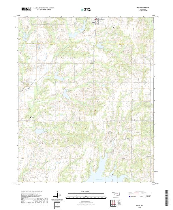
2022 Map of Byars
USGS Topo · Published 2022About this map
Byars sits at the northern edge of this landscape, where the terrain transitions across the McClain and Garvin County line. The settlement pattern is defined by small, dispersed communities and a high density of family or community burial grounds, including the Civit Cem near Civit and the Dixon Chapel Cem further east. These sites, along with Boudinot, reflect a rural Oklahoma geography shaped by section-line roads and the local drainages of Little Peavine Creek and Keel Sandy Cr. To the south, the significant expanse of Longmire Lake dominates the drainage basin of Wolf Cr. The map's grid of county roads, such as E Co Rd 1490 and Johnsonville Ave, provides a framework for tracing property lines and the evolution of these central Oklahoma agricultural townships.
Find a feature on this map
46 named features on this map. Tap any name to fly to it.
Don’t see what you’re looking for? This feature index may not catch every label — zoom into the map to look around manually.
Map Details
Editions of this 2022 Byars Map
This is the sole edition of this map. No revisions or reprints were ever made.
Other maps of this area

1898 · Pauls Valley
USGS Topo · 1:125,000

1901 · Stonewall
USGS Topo · 1:125,000

1902 · Pauls Valley
USGS Topo · 1:125,000

1957 · Ardmore
USGS Topo · 1:250,000

1963 · Ardmore
USGS Topo · 1:250,000

1964 · Byars
USGS Topo · 1:24,000

1965 · Pauls Valley NE
USGS Topo · 1:24,000
1965 · Rosedale
USGS Topo · 1:24,000

1965 · Byars SW
USGS Topo · 1:24,000

1965 · Pauls Valley
USGS Topo · 1:24,000